
Category:Satellite maps
Subcategories
This category has the following 3 subcategories, out of 3 total.
Media in category "Satellite maps"
The following 59 files are in this category, out of 59 total.
-
 2024-09-15-05 01 Sentinel-1 AWS-IW-VVVH Enhanced visualization-orthorectified.jpg 1,866 × 911; 1.15 MB
-
 Black Creek satellite map.PNG 982 × 433; 1.03 MB
-
 Black Hole Creek satellite map.PNG 356 × 479; 345 KB
-
 Chiba Port Arena.png 417 × 433; 378 KB
-
.jpg/120px-Croatia_(14400723385).jpg) Croatia (14400723385).jpg 1,800 × 1,848; 1.66 MB
Croatia (14400723385).jpg 1,800 × 1,848; 1.66 MB
-
 Crop type map gee.tif 1,629 × 1,080; 6.76 MB
-
 Davis Run satellite map.PNG 291 × 474; 304 KB
-
 DC United Buzzard Point Stadium satellite view.jpg 940 × 509; 95 KB
-
 Distance from Cape Aspro to Limassol.png 2,875 × 1,341; 4.35 MB
-
 East Branch Fishing Creek satellite map.PNG 288 × 495; 270 KB
-
.jpg/120px-Esᴛᴏɴɪᴀ_ꜰʀᴏᴍ_Sᴘᴀᴄᴇ_(50852740217).jpg) Esᴛᴏɴɪᴀ ꜰʀᴏᴍ Sᴘᴀᴄᴇ (50852740217).jpg 1,602 × 1,856; 1.14 MB
Esᴛᴏɴɪᴀ ꜰʀᴏᴍ Sᴘᴀᴄᴇ (50852740217).jpg 1,602 × 1,856; 1.14 MB
-
 Fukuoka Citizens Gymnasium.png 468 × 439; 266 KB
-
 Hiroshima Sun Plaza.png 347 × 385; 342 KB
-
 Insediamenti Agricoli.jpg 919 × 580; 384 KB
-
 Israel at night.jpg 425 × 934; 174 KB
-
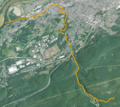
 Kawazu-Futase Kobukuro line.jpg 3,492 × 2,784; 2.88 MB
-
 Kinney Run satellite map.PNG 374 × 472; 432 KB
-
 Korea wakati wa usiku 23 March 2017.png 800 × 864; 674 KB
-
 Korean Peninsula at night from space.jpg 1,345 × 1,452; 353 KB
-
 Kyuden Gymnasium.png 756 × 439; 460 KB
-
 Lewis Run satellite map.PNG 138 × 364; 111 KB
-
 Little Mahanoy Creek satellite map.PNG 754 × 294; 500 KB
-
 Little Nescopeck Creek satellite map.PNG 856 × 231; 518 KB
-
 Little Shamokin Creek satellite map.PNG 398 × 350; 330 KB
-
 Lower Little Swatara Creek satellite map.PNG 982 × 198; 419 KB
-
_satellite_map.PNG/60px-Mahoning_Creek_(Susquehanna_River)_satellite_map.PNG) Mahoning Creek (Susquehanna River) satellite map.PNG 207 × 411; 205 KB
Mahoning Creek (Susquehanna River) satellite map.PNG 207 × 411; 205 KB
-
 Map Cartographic examples II 1992 - Touring Club Italiano CART-TEM-123.jpg 5,000 × 3,422; 17.6 MB
-
 Map Italy from satellite I 1992 - Touring Club Italiano CART-TEM-124.jpg 5,000 × 3,431; 16.9 MB
-
 Map Italy from satellite II 1992 - Touring Club Italiano CART-TEM-125.jpg 3,000 × 2,083; 1.51 MB
-
 Map Italy from satellite III 1992 - Touring Club Italiano CART-TEM-126.jpg 5,000 × 3,407; 16.87 MB
-
 Map-items-fawiki-2880x1440.png 2,880 × 1,453; 133 KB
-
 Matsuyama City General Community Center.png 410 × 426; 434 KB
-
 Messers Run satellite map.PNG 927 × 314; 589 KB
-
 Mopitt first year carbon monoxide.jpg 540 × 630; 61 KB
-
 MOPITT www.acd.ucar.edu.Web-201003-mixing ratio at surface.png 913 × 464; 44 KB
-
 Negro Hollow satellite map.PNG 287 × 521; 312 KB
-
 Night Smelt Range.png 398 × 575; 424 KB
-
 Niigata City Higashi General Sports Center.png 527 × 443; 280 KB
-
 OKB Gifu Seiryu Arena.png 743 × 376; 537 KB
-
 Photo interpretation corine land cover.PNG 902 × 320; 319 KB
-
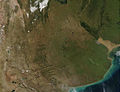 Provinz Buenos Aires Rio de la Plata Argentinien NASA.jpg 1,300 × 1,000; 282 KB
-
 Satellite map of Eyre Peninsula with all railway lines.tif 5,600 × 4,514; 96.44 MB
-
 Satellite Map of Korea.jpeg 532 × 882; 341 KB
-
 Satellite map of New Guinea.png 5,600 × 3,400; 9.03 MB
-
 Schwaben Creek satellite map.PNG 1,135 × 245; 666 KB
-
 Solomon Creek satellite map.PNG 555 × 493; 673 KB
-
 Stafford Meadow Brook satellite map.PNG 738 × 379; 659 KB
-
 Tochigi Prefectural North Gymnasium.png 768 × 441; 468 KB
-
 Tochigi Prefectural South Gymnasium.png 794 × 440; 487 KB
-
 Toyama City Gymnasium.png 498 × 419; 303 KB
-
 Toyama General Sports Center.png 405 × 430; 245 KB
-
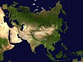 Two-point-equidistant-asia.jpg 2,048 × 1,529; 1.37 MB
-
 Twomile Run satellite map.PNG 157 × 495; 152 KB
-
 West Branch Chillisquauqe Creek satellite map.PNG 252 × 386; 238 KB
-
 Yokohama Cultural Gymnasium.png 526 × 421; 340 KB
-
 Ортографическая карта.jpg 635 × 635; 59 KB
-
 Современная карта улицы.jpg 1,280 × 1,131; 487 KB
-
 পৃথিবীর ভৌগোলিক মানচিত্র.png 480 × 599; 342 KB
-
 导航架至拔仙台 - panoramio.jpg 3,600 × 1,042; 844 KB


.jpg)


.jpg)


_satellite_map.PNG)


